top of page

SURVEY & ENGINEERING SERVICES

For Surveyors
Ortho.png

Orthomosaics

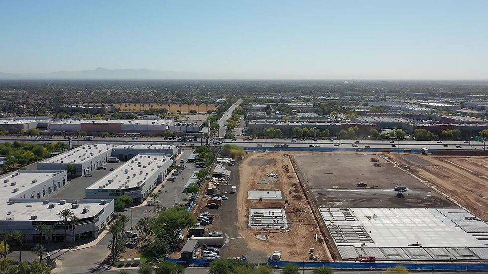
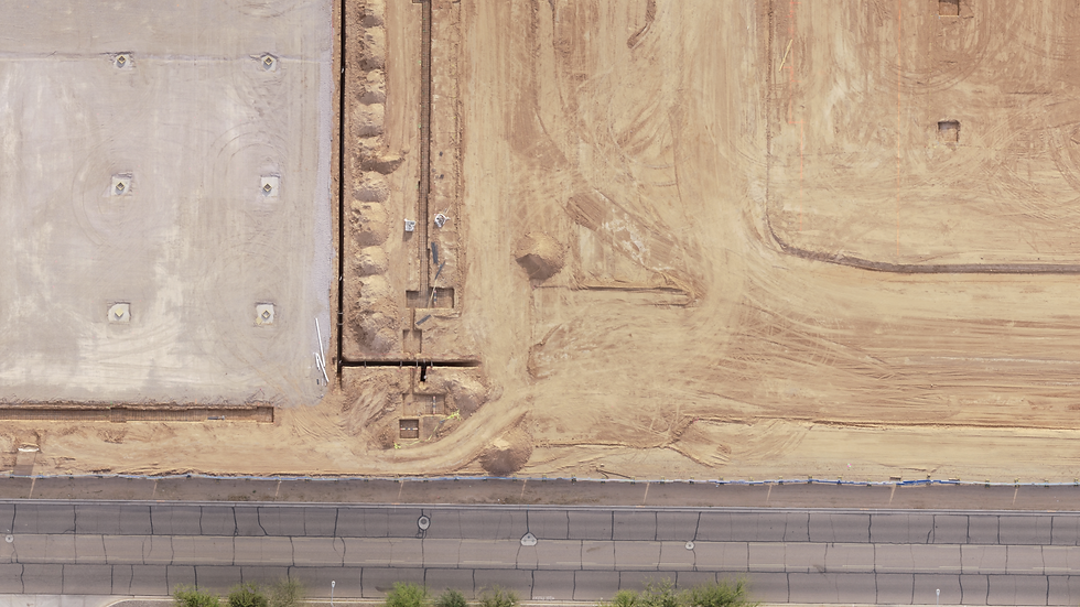
Like having your own personal satellite.

Drone photogrammetry with RTK/PPK precision produces orthomosaics (high definition geolocated map of your site) and each pixel of the image contains an X, Y & Z location in your EPSG code.

Load them into AutoCAD, Civil3D, TBC, or other professional software as a layer for your linework or design.

Delivered in .tiff or .ecw (fantastic compression so you can work fast without bogging down your workstation).
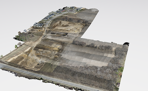
Point Cloud_edited.png

Point Clouds

Get all the measurements.

We produce Point Clouds with drone Photogrammetry and drone LiDAR.


Point Clouds have all your measurements, elevations and slopes - even under dense vegetation.

We classify points between ground and everything else so that you have a 3D surface model of your site.

Data is delivered via Cloud portal, .LAS file or .LAZ file.

Topography1.png

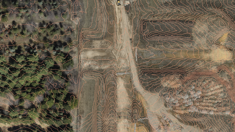
TIN Files & Contours

Topo up to four hundred acres in a day.

We use LiDAR to penetrate vegetation and map the ground below. We virtually remove non-ground items so you have a clean surface.

Grid delivered in .XML file.


Contour lines to your specs delivered in .DXF or .DWG for import.

DOWNLOAD DEMO FILES

Lacy Rd & Baxter Park Demos Include:

-ecw orthomosaic

-LiDAR point cloud

-extracted surface TIN

-site contours

-Map attached instructions for Civil3D

-example cost quote

Please tell us who you are for the link:

REQUEST A QUOTE

Our team is ready to answer your questions and provide a no-hassle quote.


CUSTOMER REVIEWS

"I just wanted to let you know how versatile your drone work is, and that I have been able to use the drone photos and data that you have recorded for IA Management in several ways. I was able to get accurate bid measurements... I just want to say thanks for your work and to let you know it has paid great dividends for IA Management."

Ron, VP of Facilities

Madison, Wisconsin

Contact Us Footer

Call:

(608) 571-7992

Wisconsin Address:

790 N Milwaukee St
Ste 302 PMB 96865
Milwaukee, WI 53202

Accounting, Invoice and Payment Address:

9450 SW Gemini Dr

Beaverton, OR 97008

  • LinkedIn
  • YouTube

© 2024 by Flyover Data, LLC

Disclaimer: CONSULTANT IS NOT A REGISTERED LAND SURVEYOR OR LICENSED PHOTOGRAMMETRIST, AND ITS SCOPE OF SERVICES DOES NOT INCLUDE LAND SURVEYING OR PHOTOGRAMMETRY SERVICES FOR WHICH REGISTRATION OR LICENSING IS REQUIRED IN ANY JURISDICTION. Consultant’s deliverables are elements of a geographic information system supporting  Client’s planning, decision-making, project management needs, marketing , and historical record of conditions at Client’s Project over time.  All data provided by Flyover should be used as a general management and marketing tool only. Drones are sometimes subject to GPS error and are not 100% correct. Drone data is always a supplement to traditional quantification methods. Unless our data has been reviewed, verified, and stamped by a professional licensed individual it may not be relied upon in any professional use case. Further, drone data should not be relied upon as a "survey" or misused in anyway which would violate any survey regulation. Please see 'About Our Data' for more information.

bottom of page